The Short Answer on Drones in National Parks
Drone rules in national parks have gotten complicated with all the misinformation flying around. So let me cut straight to it.
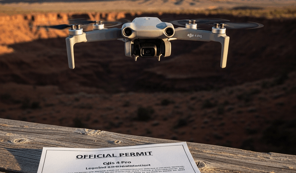
Flying your DJI Mini 4 Pro in a national park is illegal. Full stop.
The National Park Service dropped a blanket prohibition on recreational drone operations back in 2014 — all 423 NPS units, no exceptions. This isn’t a suggestion or a gray area. It’s a hard federal rule grounded in 36 CFR 1.5 and the NPS Management Policies 2006. Today, I’ll share everything you need to know so you don’t find out the hard way.
Here’s what trips up most pilots: the NPS ban operates completely separately from FAA authority. The FAA handles airspace and hands out Part 107 commercial licenses. The NPS controls the land beneath that airspace. You could hold a valid Part 107 cert, carry $2 million in liability insurance, and fly by every FAA rule ever written — and still be breaking federal law the second your drone lifts off from park property. Your certificate doesn’t protect you here. Not even a little.
The park superintendent owns jurisdiction over the land. The FAA owns jurisdiction over the sky. They don’t answer to each other. You need a green light from both to legally operate over a national park, and that almost never happens outside major commercial film productions.
National Park vs National Forest vs State Park
Probably should have opened with this section, honestly. Most pilots assume all protected public lands run on the same rulebook. They don’t. Not even close.
National Parks fall under the National Park Service. Drones are banned, period.
National Forests are a different animal entirely. The USDA Forest Service manages them — not the NPS. The Forest Service hasn’t rolled out a blanket drone ban. You can fly in most national forests if you maintain line of sight, follow standard FAA recreational rules, and keep your Mini 4 Pro under applicable weight thresholds. No special permit required for casual flying. That’s a massive distinction most articles just gloss over. Check the specific forest’s website for local closures, but the default answer in a national forest is generally yes.
State Parks land in a third category — and this is where things get genuinely messy. Every state writes its own rules. Some mirror the NPS model and ban drones outright. Others allow them with a simple registration and a submitted flight plan. A handful barely restrict them at all. You have to check your specific state’s park agency website. No shortcut exists here.
Two concrete examples worth knowing:
- California State Parks: Generally prohibit drones across state park land, closely mirroring the NPS approach.
- Colorado State Parks: Allow drones in many locations — you register and notify the park manager at least 48 hours in advance. That’s it.
But what is the fastest way to figure out which category your destination falls into? In essence, it’s a quick agency check. But it’s more useful than it sounds. Start by confirming whether your spot is actually a National Park. The NPS website lists all 63 clearly. Not on that list but still federally protected? Find out which agency manages it. The USDA Forest Service site shows every national forest. For state parks, go straight to your state’s Department of Parks and Recreation or equivalent.
This takes five minutes. Most pilots skip it and regret it at the trailhead.
How to Apply for an NPS Special Use Permit
Permits exist. They’re just brutally restrictive and almost never issued for recreational use. Don’t make my mistake of assuming otherwise before checking.
The NPS issues Special Use Permits at the individual park level — not nationally. No single application covers every park. Each superintendent evaluates requests independently. Yellowstone’s permit office runs differently than Joshua Tree’s, which runs differently than the Everglades’. Same agency, completely different process on the ground.
If you’re serious about pursuing this — and you understand that recreational approvals are genuinely rare — here’s how the typical process unfolds:
- Contact the park’s visitor services or administrative office directly. Pull the phone number or email from the park’s official NPS page, not a third-party site.
- Submit a written request with a clear stated purpose. “I want cool footage” doesn’t cut it. Commercial filming, scientific research, and official documentation are the categories that get real consideration.
- Include proof of liability insurance — minimum $1 million for commercial operations — alongside a detailed flight safety plan, your Part 107 certificate if applicable, and a map showing proposed flight zones and altitude ceilings.
- Show genuine coordination with park staff. They need confidence you won’t disturb wildlife, disrupt other visitors, or create operational headaches.
- Wait. Processing runs anywhere from four weeks to several months depending on the park and the season.
Even after all that, recreational permits get approved in a tiny slice of cases. The default posture from park management is no. Commercial filmmakers — especially those shooting for established networks or studios — have meaningfully better odds. A solo pilot chasing landscape footage faces a steep climb.
The NPS website documents the official permit inquiry process under Special Use Permits, with directions to contact your specific park. Slow communication is the norm. Expect multiple requests for additional documentation before anyone makes a decision.
Where You Can Legally Fly Near National Parks
Flying just outside park boundaries is often legal. Not always — it depends entirely on who manages that adjacent land.
Many national parks sit surrounded by National Forest Service land, BLM (Bureau of Land Management) territory, or private property. National forests, as mentioned earlier, operate under different rules. BLM land generally permits drone operations if you follow FAA regulations and check for active TFRs (Temporary Flight Restrictions) in the area. Private land requires landowner permission — proximity to a park doesn’t imply any kind of access.
Here’s where pilots consistently get tripped up: they assume airspace directly above a national park is automatically restricted. It’s not. Airspace restrictions come from FAA designations, not NPS land boundaries. Pull up the B4UFLY app and cross-reference sectional charts for your specific location. Class B or Class C airspace near a park might be restricted, but that restriction exists because of nearby airports — not because the park demanded it.
The actual violation is launching or landing on NPS property. Overflying at altitude in unrestricted airspace sits in grayer territory — but intentionally overflying a park to grab aerial footage still runs afoul of 36 CFR 1.5 and the spirit of the ban. Rangers actively monitor for unauthorized drones. Enforcement is inconsistent enough to feel unpredictable, which honestly makes it worse, not better.
Before any trip, spend 20 minutes mapping alternative launch spots. Nearby public lands, overlooks just outside the park boundary, adjacent state land — these often deliver the same visual payoff with zero legal exposure.
What Happens If You Fly Without Permission
I knew someone who got caught launching a Mini 3 Pro from a trailhead inside a major park. Another visitor reported it within minutes. A ranger intervened before he got a second battery in the air. The outcome was considerably worse than he’d imagined.
Civil fines start at $5,000 for unauthorized drone operations on federal land — that’s the baseline under 36 CFR 1.5. Equipment confiscation happens on the spot. Your drone gets seized as evidence, not stored somewhere you can retrieve it next week.
Criminal charges are possible if the violation is egregious or a repeat offense. Prosecution rarely happens on a single first offense, but the authority exists. Part 107 certificate holders face an additional layer of exposure — violations can trigger an FAA investigation that goes on your record even if you keep the license. I’m apparently someone who reads the fine print on these things, and the FAA review process alone is more disruptive than most pilots anticipate.
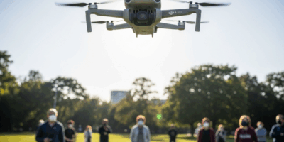
Rangers patrol popular areas regularly. Visitors report drones constantly — more than you’d expect. Social media footage makes identification straightforward. If your Mini 4 Pro is running default colors and an unmasked serial number on the transmitter, you’re not difficult to trace.
The practical damage isn’t just the fine. It’s the legal calls, the enforcement timeline, the possible license review, the hassle that stretches weeks past the original incident. None of it is proportionate to the footage.
Check the rules before you go. Not at the trailhead. Not when you spot a perfect shot. Before you pack the car.


Stay in the loop
Get the latest dronefaaregulations updates delivered to your inbox.