Air Data Systems for Drones: What You Need to Know
Drone flight systems have gotten complicated with all the technical specs and engineering terms flying around. As someone who’s worked with UAV air data systems on both custom builds and commercial platforms, I learned everything there is to know about how drones sense and respond to the air around them. Today, I will share it all with you.
Most drone pilots take stable flight for granted. You push the stick forward, the drone moves forward. Simple. But behind that simplicity is an air data system working incredibly hard to keep your aircraft flying smoothly, and understanding how it works makes you a better pilot.
What Air Data Systems Actually Do
At its core, an air data system measures atmospheric conditions and feeds that information into the flight controller. We’re talking airspeed, altitude, temperature, and barometric pressure. The flight controller uses this data to make constant adjustments to motor speed, pitch, roll, and yaw. Without accurate air data, your drone would be fighting the wind instead of compensating for it.
The Hardware Behind It
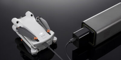
Probably should have led with this section, honestly. The components are simpler than you’d expect:
- Pitot Tubes: Measure dynamic air pressure to determine airspeed. You’ll see these more often on fixed-wing drones than multirotors, but the principle applies across platforms.
- Static Ports: Measure ambient static pressure for altitude calculations. Your barometer is essentially a static port.
- Temperature Sensors: Detect ambient air temperature, which affects air density and therefore flight performance.
These sensors feed raw data into processing algorithms that calculate the values your flight controller needs. The better the algorithms, the more accurately your drone responds to changing conditions.
Real-World Applications
Air data systems aren’t just academic—they directly affect how well drones perform specific jobs.
In precision agriculture, accurate altitude and airspeed data ensures even coverage during crop spraying. Fly too fast or too high and you get uneven application. The air data system keeps the drone at the right height and speed automatically, even as terrain changes beneath it.
Delivery drones rely on air data for route optimization. Wind speed and direction data help the drone choose the most energy-efficient path, which extends range and improves delivery times. That matters when you’re running dozens of deliveries per day on battery power.
Surveillance and Public Safety
For surveillance and SAR operations, air data systems keep drones stable enough to capture usable footage in conditions that would otherwise make the video unwatchable. Border patrol, wildlife monitoring, disaster response—all of these depend on a drone that can hold its position and maintain smooth flight despite wind and weather.
That’s what makes good air data systems endearing to us commercial drone operators—they’re the invisible foundation that everything else depends on.
How the Technology Is Advancing
Miniaturization has been the biggest driver of improvement. Sensors that used to require significant space and weight now fit on tiny circuit boards. This lets even small consumer drones carry sophisticated air data capabilities. The algorithms processing the data have gotten smarter too—they filter out noise, compensate for sensor drift, and provide more granular analysis than ever before.
Integration With Other Systems
Modern drones don’t treat air data in isolation. It’s fused with GPS data, inertial navigation system output, visual positioning data from downward-facing cameras, and even obstacle avoidance sensor input. This sensor fusion approach gives the flight controller a much more complete picture of the aircraft’s state than any single system could provide.
AI and machine learning are starting to play a role here too. Predictive algorithms can anticipate wind gusts based on patterns in the air data, adjusting the drone’s flight path proactively rather than reactively. It’s early days for this technology, but the results are already impressive.
Challenges You’ll Encounter
Sensor calibration is an ongoing requirement. Pitot tubes can get clogged with debris, barometric pressure sensors drift over time, and temperature sensors lose accuracy. Regular calibration and maintenance aren’t optional if you want reliable data.
Environmental factors are a constant battle too. Dust, moisture, and extreme temperatures all affect sensor performance. Operating in a desert environment is a very different challenge than flying in humid coastal air, and your air data system needs to be maintained accordingly.
Regulations and Compliance
As drone regulations evolve, air data system requirements are becoming part of the compliance picture. The FAA and other aviation authorities are increasingly looking at the accuracy and reliability of onboard systems as part of their airworthiness frameworks. Operators need to ensure their systems meet current standards and stay updated as requirements change.
Where This Is All Heading
The future of UAV air data systems is tied to the future of autonomous flight. As drones move toward beyond-visual-line-of-sight (BVLOS) operations and truly autonomous missions, the demand for more accurate, more reliable, and more redundant air data systems will only grow. Nanotechnology is shrinking sensors further, communication improvements are enabling real-time data sharing across drone fleets, and standardization efforts are making it easier to integrate components from different manufacturers.
If you fly drones professionally, understanding your air data system isn’t optional knowledge—it’s foundational. The better you understand how your drone perceives the air around it, the better decisions you’ll make in the field.