

Updated January 2026 | LAANC system operational since 2018, coverage expanded to 726 FAA facilities
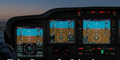
Last week I needed to fly a roof inspection 3.2 miles from Phoenix Sky Harbor (PHX) – Class B airspace. Here is exactly how I got LAANC approval in under 5 minutes using the Aloft (formerly Kittyhawk) app on my iPhone.
Real LAANC Example: PHX Class B, Grid 45NW, requested altitude 200ft AGL, approved instantly at 100ft. The grid I was in had a 100ft ceiling – you will not always get what you request. Check LAANC UAS Facility Maps at faa.gov/uas before planning.
Understanding Airspace Classifications
The National Airspace System (NAS) is divided into different classes of airspace, each with specific rules, services, and entry requirements. For drone pilots operating under Part 107, understanding Class B, C, and D airspace is essential because these controlled environments surround airports and require authorization before operations can legally occur.
While all three classes involve controlled airspace around airports, they differ significantly in size, complexity, entry requirements, and the services provided to manned aircraft. Understanding these differences helps drone pilots navigate the authorization process and operate safely near airports of all sizes.
Class B Airspace: Major Hub Airports
Class B airspace surrounds the nation’s busiest airports, where thousands of commercial flights operate daily carrying millions of passengers. This is the most complex and restrictive airspace classification.
Defining Characteristics
Airports with Class B airspace include:
- Hartsfield-Jackson Atlanta (ATL) – Busiest airport in the world
- Los Angeles (LAX), Chicago O’Hare (ORD), Dallas-Fort Worth (DFW)
- New York Kennedy (JFK), LaGuardia (LGA), Newark (EWR)
- San Francisco (SFO), Seattle (SEA), Denver (DEN)
- Miami (MIA), Phoenix (PHX), Charlotte (CLT)
Approximately 37 airports in the United States have Class B airspace.
Airspace Structure
Class B airspace resembles an upside-down wedding cake with multiple layers:
- Surface area – Inner core extending from surface to 10,000 feet MSL typically, radius of 5-15 miles
- Secondary shelves – Outer rings starting at 1,500-3,000 feet extending to outer boundaries
- Outer limits – Typically extend 20-30 miles from primary airport, sometimes 40+ miles
- Upper limit – Usually 10,000 feet MSL, sometimes higher
- Individual design – Each Class B is custom-tailored to local traffic patterns and terrain
Example: Los Angeles (LAX) Class B:
- Surface area extends approximately 10 miles from airport
- Outer rings extend 30+ miles from primary airport
- Upper limit is 10,000 feet MSL over most areas
- Encompasses multiple satellite airports (Burbank, Long Beach, Santa Monica)
- Complex shape accommodating Pacific Ocean, mountains, and dense population
Class B LAANC Authorization
Obtaining authorization for Class B airspace operations is more complex than other airspace classes:
LAANC availability:
- Most Class B airports now have LAANC capability
- Grids tend to have very conservative ceilings
- Large surface areas (0 ft ceiling) requiring manual authorization
- Some areas have 50-100 ft ceilings at considerable distances from airport
Typical LAANC grid patterns for Class B:
- 0-5 miles from airport: Mostly 0 feet (no automatic authorization)
- 5-10 miles: 0-100 feet typical
- 10-20 miles: 100-200 feet depending on location relative to approaches
- 20+ miles: 200-400 feet in outer areas
- Under approach/departure paths: Heavily restricted regardless of distance
Manual authorization process:
- Required for surface areas and altitudes above LAANC ceilings
- Submit through DroneZone portal
- Processing time: 60-120 days typical for Class B
- Requires compelling operational justification
- May require coordination with ATC facility
- Often approved with restrictive conditions
Operational Considerations in Class B
Class B airspace has the highest volume of manned aircraft traffic:
- Constant arrival/departure flows – Aircraft every 60-90 seconds during peak hours
- Multiple approach paths – Aircraft arriving from all directions
- Go-arounds and missed approaches – Aircraft may suddenly descend to low altitudes
- Helicopter traffic – News, medical, and tour helicopters operating at low altitudes
- VFR corridors – Manned aircraft may be flying specific low-altitude routes
Safety best practices for Class B operations:
- Operate at lowest practical altitude
- Minimize time aloft
- Use visual observers specifically watching for aircraft
- Monitor approach frequency if radio-equipped (not required but prudent)
- Plan operations during lowest traffic periods (early morning, late night)
- Have immediate descent/landing plan if aircraft appears
Class C Airspace: Regional Airports
Class C airspace surrounds mid-sized airports with radar approach control and significant commercial service, but less traffic than Class B airports.
Defining Characteristics
Typical Class C airports:
- Regional airports with scheduled airline service
- 100,000 to several million passengers annually
- Radar approach control (TRACON) providing separation services
- Examples: Raleigh-Durham (RDU), Nashville (BNA), Austin (AUS), Portland (PDX)
Approximately 130 airports have Class C airspace in the United States.
Airspace Structure
Class C airspace has a standardized two-tier structure (with local variations):
- Inner circle (surface area):
- Extends from surface to 4,000 feet AGL typically
- Radius of 5 nautical miles from primary airport
- Outer shelf:
- Extends from 1,200 feet AGL to 4,000 feet AGL typically
- Radius of 10 nautical miles from primary airport
- Outer area:
- Extended area where radar services available but not required
- Extends to 20 nautical miles (not charted)
Example: Portland International (PDX) Class C:
- Inner circle: Surface to 4,000 feet, 5 NM radius
- Outer shelf: 1,200 to 4,000 feet, 10 NM radius
- Custom shape accommodating nearby airports and terrain
Class C LAANC Authorization
LAANC grids for Class C airspace tend to be more permissive than Class B:
Typical LAANC ceiling patterns:
- 0-2 miles from airport: 0-50 feet typical, with approach/departure paths at 0 feet
- 2-5 miles: 100-200 feet common
- 5-10 miles: 200-400 feet depending on location
- Beyond 10 miles: Usually outside controlled airspace or full 400-foot ceiling
Authorization process:
- Most locations offer instant LAANC approval up to published ceilings
- Surface areas (0 ft) still require manual authorization
- Manual authorizations process faster than Class B (30-60 days typical)
- More likely to receive approval for operations near Class C than Class B
Operational Considerations in Class C
Class C airports have moderate to heavy traffic but more predictable patterns than Class B:
- Scheduled airline traffic – Regional jets and smaller mainline aircraft
- General aviation traffic – Significant private aircraft activity
- Defined approach procedures – Aircraft follow published instrument approaches
- Radar coverage – ATC actively managing all traffic in the airspace
- Lower traffic density than Class B – More gaps in arrival/departure flows
Best practices for Class C operations:
- Check NOTAMS for unusual traffic (airshows, events, military exercises)
- Understand typical traffic flows (which runways are in use)
- Avoid peak traffic hours (early morning, evening rushes)
- Maintain heightened vigilance during approach/departure periods
- Use ADS-B receivers if available to detect aircraft
Class D Airspace: Towered Airports
Class D airspace exists around smaller airports with operating control towers but without radar approach control services.
Defining Characteristics
Typical Class D airports:
- Small to medium airports with control towers
- May have limited airline service or primarily general aviation
- Tower provides clearances and sequencing but not radar separation
- Examples: Small municipal airports, military airfields, reliever airports
Approximately 400-500 airports have Class D airspace in the United States.
Airspace Structure
Class D airspace has the simplest structure:
- Cylindrical shape – Typically circular (not layered like Class B or C)
- Surface to 2,500 feet AGL – Standard upper limit, with some variations
- Radius of 4.3 nautical miles – Standard size, customized at some airports
- Extensions along instrument approaches – Some Class D has “keyhole” extensions
- Part-time operation – Many Class D airports only have controlled airspace during tower hours
Part-time Class D airspace:
- When tower is operating: Class D airspace is active
- When tower is closed: Airspace reverts to Class E or G (check chart)
- Tower hours published in Chart Supplement
- LAANC grids often reflect different ceilings during tower vs. non-tower hours
Class D LAANC Authorization
LAANC grids for Class D airspace are generally the most permissive of the controlled airspace classes:
Typical LAANC ceiling patterns:
- Runway surface areas: 0 feet (no automatic authorization directly over runways)
- Approach/departure corridors: 0-100 feet within 1 mile of runway ends
- 1-2 miles from airport: 100-200 feet typical
- 2-4 miles: 200-400 feet common
- Lateral areas away from approaches: Often 400 feet even relatively close to airport
Authorization characteristics:
- LAANC approval usually instant for published ceilings
- Manual authorizations process quickest for Class D (30-45 days typical)
- Approval rates higher than Class B or C
- Tower coordination simpler due to lower traffic volume
Operational Considerations in Class D
Class D operations involve the lowest controlled airspace traffic density:
- General aviation traffic – Small aircraft, flight training, recreational flying
- Predictable patterns – Traffic follows standard pattern procedures
- Visual flight rules common – Many pilots operating VFR in pattern
- Helicopter operations – Common at Class D fields
- Variable traffic by time – Very busy during training hours, quiet at other times
Best practices for Class D operations:
- Understand traffic pattern direction and altitude
- Monitor CTAF (Common Traffic Advisory Frequency) if equipped
- Note runway in use and expect aircraft on departure/approach
- Watch for flight training aircraft conducting touch-and-goes
- Be aware of helicopter operations at lower altitudes
Comparing the Three Airspace Classes
Understanding the differences helps determine what to expect:
Size Comparison
| Characteristic | Class B | Class C | Class D |
|---|---|---|---|
| Typical lateral extent | 30+ miles | 10 miles | 4-5 miles |
| Vertical extent | Surface to 10,000 ft | Surface to 4,000 ft | Surface to 2,500 ft |
| Structure | Multi-tiered | Two-tiered | Cylindrical |
Traffic Comparison
| Airspace | Typical Traffic Volume | Aircraft Types |
|---|---|---|
| Class B | Very High (1,000+ ops/day) | Large jets, regional jets, GA, helicopters |
| Class C | Moderate (200-500 ops/day) | Regional jets, turboprops, GA, helicopters |
| Class D | Low to Moderate (50-300 ops/day) | Primarily GA, some regional service, helicopters |
Authorization Comparison
| Characteristic | Class B | Class C | Class D |
|---|---|---|---|
| LAANC typical ceilings | 0-200 ft most areas | 100-400 ft typical | 200-400 ft common |
| Surface area extent | Very large (10-15 mi) | Moderate (5 mi) | Small (4-5 mi) |
| Manual auth time | 90-120 days | 45-90 days | 30-60 days |
| Approval difficulty | Most difficult | Moderate | Easiest |
LAANC Ceiling Grids: How They’re Determined
Understanding why certain areas have specific ceilings helps predict LAANC availability:
Factors Affecting LAANC Ceilings
- Proximity to runways – Closer = lower ceilings
- Approach/departure paths – Extended centerlines heavily restricted
- Instrument approach procedures – Published approach altitudes affect grid design
- Departure procedures – SIDs (Standard Instrument Departures) create restricted areas
- Traffic patterns – Visual traffic pattern altitudes considered
- Terrain and obstacles – Minimum vectoring altitudes affect ceilings
- Local coordination – ATC facility input on acceptable drone altitudes
Why Some Areas Have 0-Foot Ceilings
Surface areas (0 ft ceilings) exist for critical zones:
- Runway surfaces and immediate vicinities – Too dangerous for any routine authorization
- Final approach corridors – Aircraft descend to very low altitudes
- Departure climb-out areas – Aircraft climbing from runway
- Missed approach areas – Where aircraft execute go-arounds
- High-traffic concentration zones – Where separation would be impossible
These areas require manual authorization because each request must be individually evaluated considering specific circumstances.
Surface vs. Altitude-Based Restrictions
A critical concept that confuses many pilots: controlled airspace applies from the surface OR from a specified altitude.
Surface Area Airspace
When sectional charts show solid lines (Class B, C, or D):
- Controlled airspace extends from surface upward
- Authorization required for any altitude from 0 feet up
- Even hovering at 5 feet requires authorization
- Cannot legally take off without authorization in surface area
Altitude-Based Airspace
When charts show dashed lines (Class C and B outer shelves):
- Controlled airspace starts at specified altitude (e.g., 1,200 ft or 2,500 ft)
- Below that altitude, airspace is Class G (uncontrolled)
- Can operate below shelf altitude without authorization
- Once entering the shelf, authorization required
Example scenario:
You’re operating 8 miles from a Class C airport. The sectional shows the outer shelf starts at 1,200 feet AGL.
- Operating at 200 feet: You’re in Class G airspace (no authorization needed from ATC)
- Operating at 1,500 feet: You’re in Class C airspace (authorization required)
- Operating at 1,100 feet: You’re in Class G airspace (no authorization needed)
However, Part 107 limits you to 400 feet AGL anyway, so you’ll rarely encounter shelf altitudes in practice. But understanding the concept is important for complete airspace knowledge.
Reading Sectional Charts for Class B, C, and D
Sectional charts use standardized symbology to depict airspace:
Class B Depiction
- Solid blue lines – Define boundaries of each shelf
- Altitude numbers in boxes – Show ceiling/floor of each area (e.g., “100/SFC” = surface to 10,000 ft)
- Complex layered structure – Multiple altitude annotations showing different shelves
Class C Depiction
- Solid magenta lines – Define inner surface area
- Dashed magenta lines – Define outer shelf
- Altitude annotations – Show ceiling and floor (e.g., “40/SFC” and “40/12”)
- Simpler structure than Class B – Usually just two layers
Class D Depiction
- Dashed blue lines – Define airspace boundary
- Number in box – Shows ceiling in hundreds of feet (e.g., “25” = 2,500 feet)
- Single layer – Typically just one altitude annotation
- Part-time indication – May show times when airspace is active
Special Procedures and Considerations
When LAANC is Unavailable
Not all controlled airports have LAANC capability yet:
- Check LAANC coverage maps to verify availability
- If LAANC unavailable, must use manual authorization through DroneZone
- Allow 90+ days for processing
- Provide detailed justification and safety case
Emergency Operations in Controlled Airspace
Public safety agencies may need to operate during emergencies:
- Certificate of Authorization (COA) can provide standing authority
- Emergency COAs available for immediate needs
- Coordination with ATC facility essential
- Operations may be approved in areas normally restricted
Night Operations in Controlled Airspace
LAANC authorization for controlled airspace during night operations:
- Same LAANC process applies at night
- Must still meet Part 107 night operation requirements (anti-collision lighting, training)
- Consider that manned aircraft visibility is reduced at night
- Some facilities may have different ceilings or restrictions for night operations
Conclusion: Master Controlled Airspace Operations
Understanding Class B, C, and D airspace is fundamental to professional drone operations. The differences between these airspace classes—in size, traffic volume, authorization procedures, and operational complexity—directly affect how and where you can legally fly.
Key takeaways:
- Class B is the most restrictive, surrounding the busiest airports with large, complex airspace
- Class C offers moderate restrictions around regional airports with more permissive LAANC grids
- Class D is the most accessible controlled airspace, surrounding smaller towered airports
- LAANC makes authorization simple for operations within approved altitude ceilings
- Manual authorization is required for surface areas and operations above LAANC ceilings
- Safety requires going beyond minimum legal requirements, especially in busy airspace
With LAANC capability now covering most controlled airports, drone pilots have unprecedented access to operate near airports legally and safely. Understanding the airspace structure, using the authorization tools properly, and maintaining high safety standards allows professional operators to work in virtually any environment while protecting the safety of the National Airspace System.


Stay in the loop
Get the latest dronefaaregulations updates delivered to your inbox.